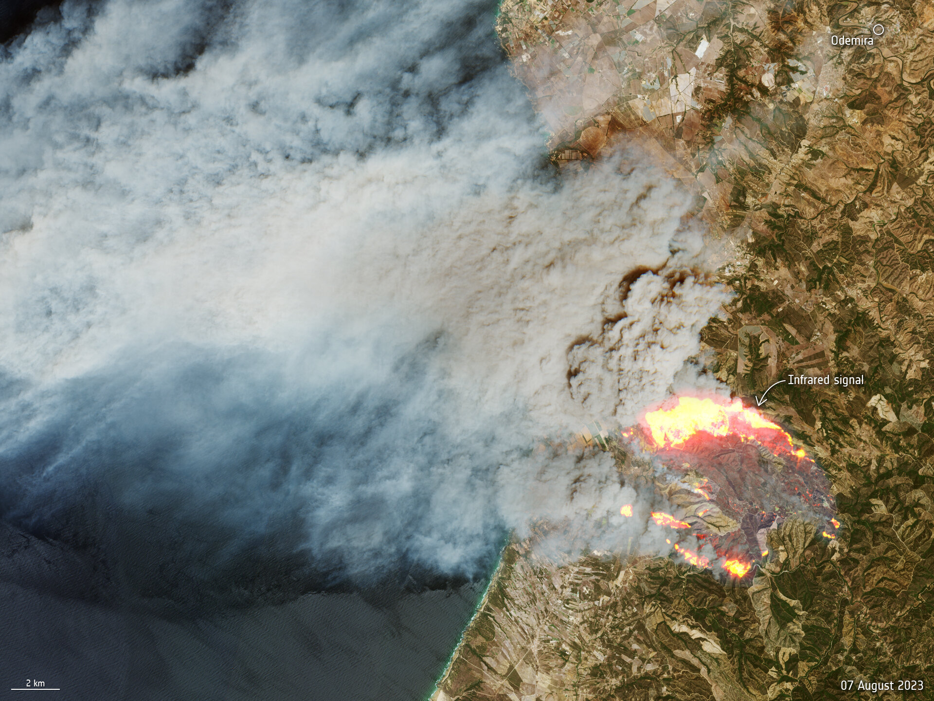
As Portugal swelters under a scorching heat wave, a devastating wildfire erupted on 5 August in the Alentejo region. This gripping image, captured by the Copernicus Sentinel-2 satellite mission, reveals the extent of the fire on 7 August.
The billowing smoke from the fire, carried by the wind towards the Atlantic, is clearly visible in this true color Sentinel-2 image. By overlaying data from the satellite’s shortwave infrared channels, the heat sources associated with the fire front are highlighted.
Reports indicate that hundreds of firefighters are battling the blaze, which is spreading southwards towards the popular tourist destination of Algarve.
Other countries in southern Europe have also been grappling with intense heat and wildfires in recent weeks. In fact, according to the World Meteorological Organization, July 2023 is likely to go down as the hottest month ever recorded.
The Copernicus Sentinel-2 mission relies on a pair of identical satellites equipped with an advanced multispectral imager. With 13 spectral bands, this innovative technology enables monitoring of changes in Earth’s land and vegetation.
,,